The City of Pitt Meadows is in the process of developing a Pedestrian and Cycling Master Plan and wants your input. Please go to the City of Pitt Meadows' website, where you will find a link to a survey.
If you're planning to attend Pitt Meadows Day on June 2, Urban Systems will have a booth (I believe together with the HUB/BAC booth/bike parking near or at the baseball diamond) where you can get more information on the Plan and hard copies of the survey will be available as well.
Bike parking will be available at Pitt Meadows Day from 11:00 a.m. till 4:30 p.m. I'm not sure what the hours are for the Urban Systems booth.

In this blog the topic of urban/lifestyle cycling is explored in the wider context of city planning & design, sustainability, local economics, environment, health, recreation and broader topics in transportation.
Wednesday, May 30, 2012
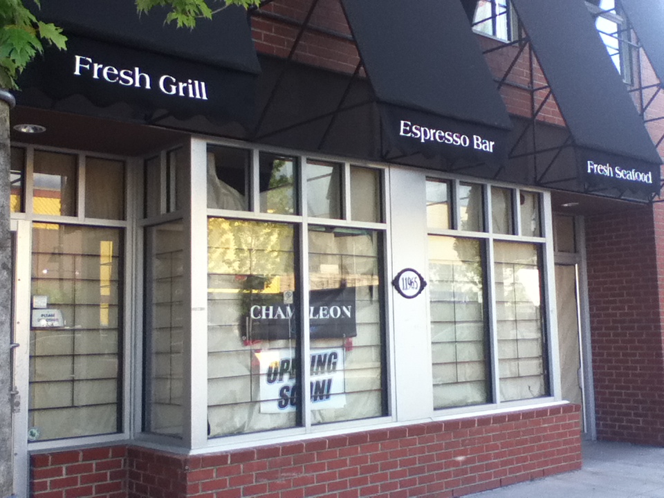
Welcome to "downtown" Chameleon!
A little bit of "fine urban texture" coming to the fabric of downtown Maple Ridge on 224th Street next to HSBC Bank. Best of luck to Chameleon restaurant.


Monday, May 28, 2012
It's time to ride!!
If you have not yet hit the roadways and pathways of the regions on your bike, here are a few photos to get you in the mood. All were taken in Vancouver over the gloriously sunny last weekend.
If you don't know it already, Vancouver enjoys a wonderful network of traffic-calmed residential streets and dedicated pathways that make it a very safe and enjoyable city to ride.
To direct your urban cycling adventures, I would recommend you get the "Bike Vancouver - Bicycle route map and info guide". It is a credit-card sized foldout map detailing the entire cycling network for Vancouver city. It is available at the bike repair desk at the Mountain Equipment Co-op on West Broadway Avenue (among other places).
 |
| Stanley Park Seawall at Coal Harbour. Remember, bikes go counter-clockwise around the park |
 |
| 10th Avenue Bikeway. Great riding! |
 |
| Stanley Park Seawall bikeway at Siwash Rock. |
 |
| Glorious treelined street (perhaps 7th Avenue) Kitsilano. |
 |
| Doesn't get much nicer! |
Tuesday, May 15, 2012
Vancouver, Montreal, Portland, Minneapolis all get high “BikeScore” marks with new measuring tool
This just out from UBC
University of British Columbia researchers are making bikeability research easily accessible to consumers and city planners by introducing bikeability “heat maps” in partnership with Seattle-based Walk Score® at www.walkscore.com/bike.
Combining data on availability of cycling infrastructure (bike lanes and trails), topography (hilliness), desirable destinations (attractions, shops and restaurants) and road connectivity, researchers from UBC’s School of Population and Public Health and Simon Fraser University worked with web developers from Walk Score® to develop algorithms to make the information easily accessible online.
Heat maps of Bike Score™ for 10 Canadian and 10 U.S. cities were launched today during National Bike Month in the U.S. and in advance of Bike Month in Canada. Victoria, Vancouver and Montreal rate highest in bikeability for Canadian cities; while Minneapolis, Portland and San Francisco lead in the U.S.
Sunday, May 6, 2012
A great day for a ride around Barnston Island!
 |
| A lovely little ferry ride over to the island. A few other cyclists had the same idea to tour the island. |
 |
| A 9.8 kilometer circle of virtually carless, pastoral bliss. |
 |
| Take the whole lane... both of them! |
 |
| Along the route... reminds us of a Saltspring Island scene. |
Subscribe to:
Posts (Atom)